|
Basic data of the trail:
(Translated by Mónica and Elizabeth)
- Promoter and producer:
Guardo
Town Council
Santa Bárbara Street, 2, 34880 / + 34 979 85 00 76
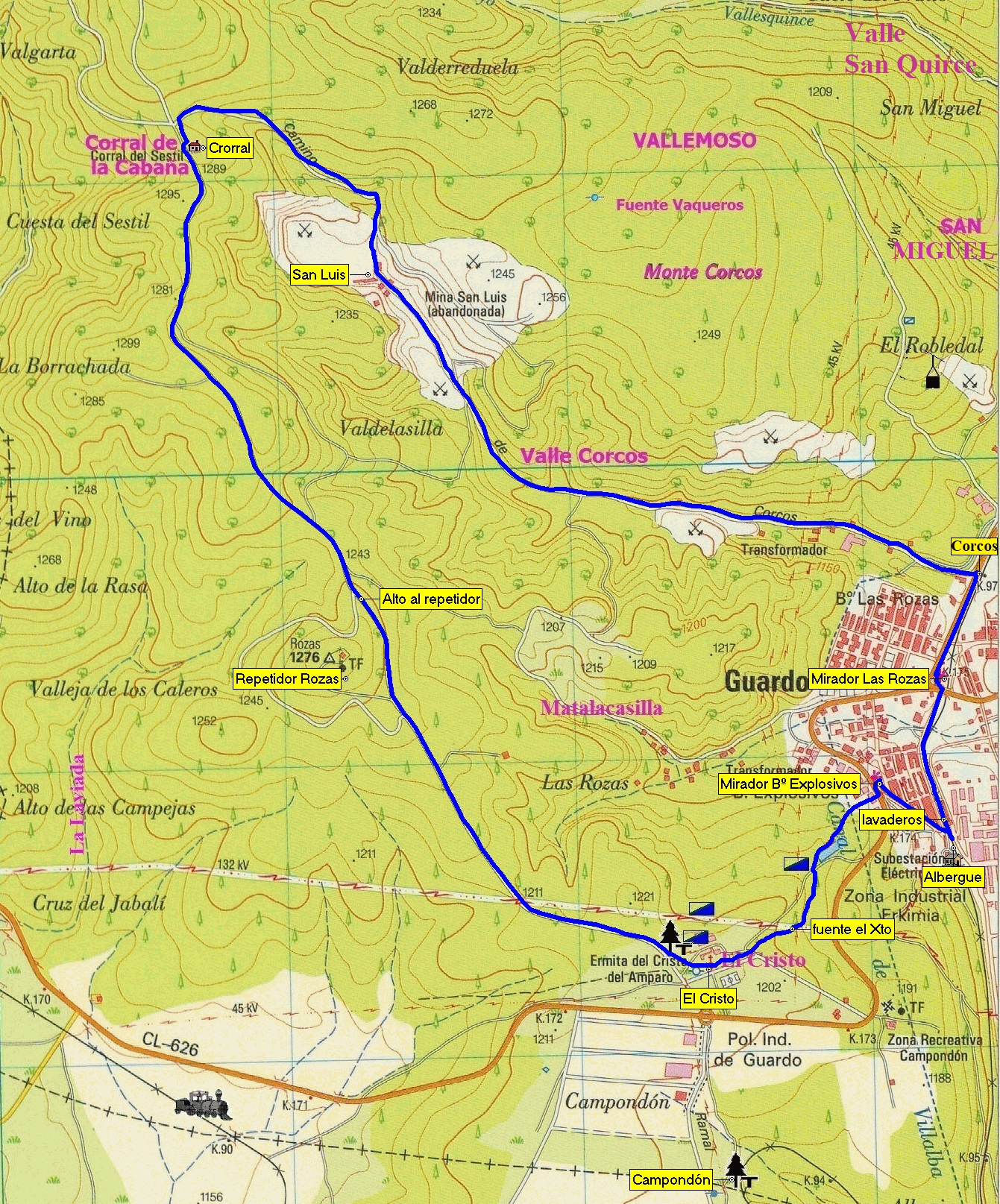
- Localities: Guardo
- Total distance (Length): 9,64 km.
- Type of route: circular
- Level of difficulty: Low
- Recommended season: the whole year.
- Accesses:
From Palencia by c-615: 96 km.
From León through Almanza: 87 km.
From Oviedo by AP-66 and Cistierna: 180 km.
From Santander through Reinosa-Aguilar: 166 km.
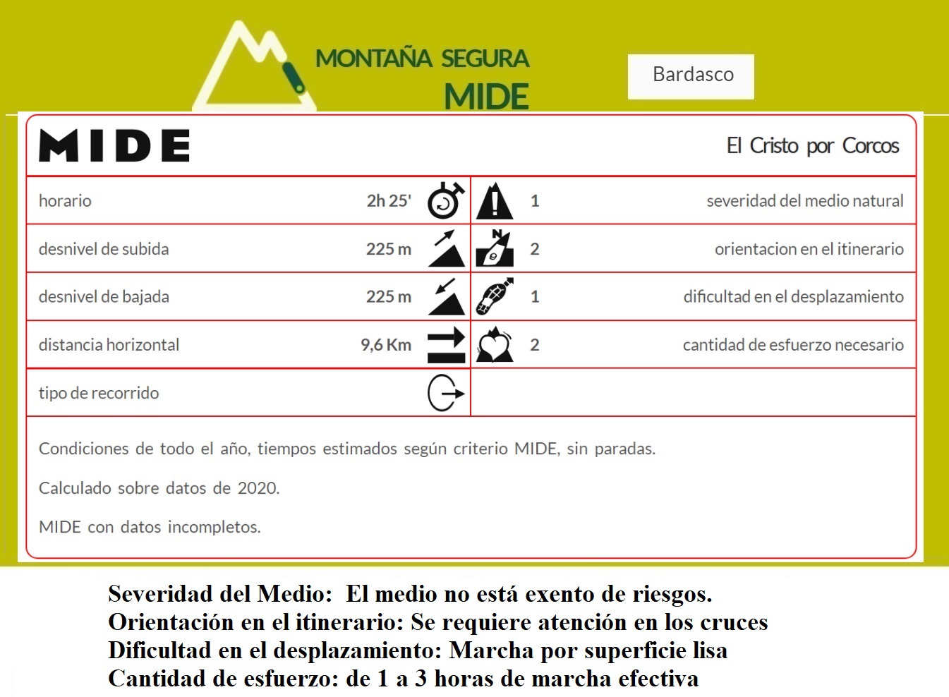
- Estimated duration in both directions: 2 h 25 min
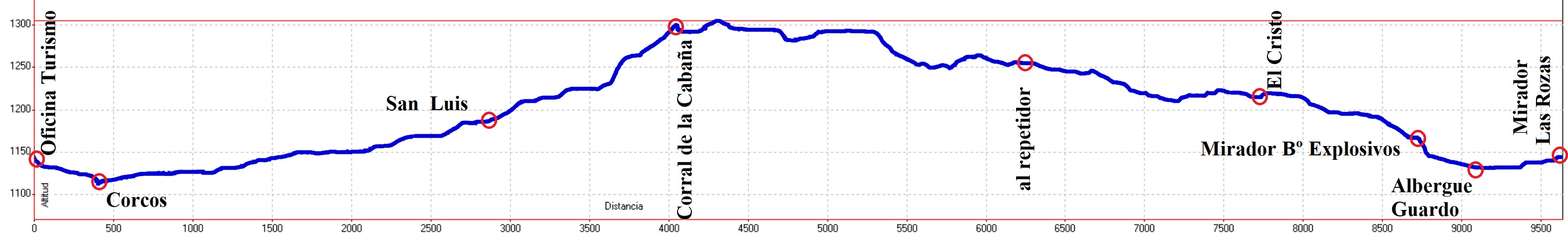
- Cumulative elevation gain: 225 m
- Cumulative elevation loss: 225 m
- Maximum elevation: 1302 m
- Minimum elevation: 1119 m
- Elevation at the beginning: 1135 m
- Elevation at the end: 1135 m
- Ciclability: 100%
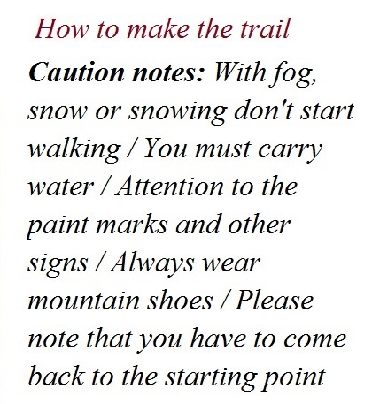
- Overlap with hunting activities: Be cautious in hunting season.
Wear clothes in bright colours and don’t leave of the paths.
- Vanishing points: Most of the route goes by paths relatively close
to roads or track for cars.
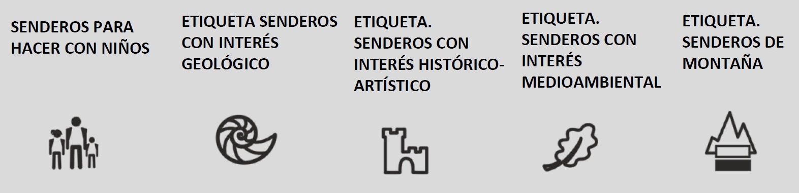
- Other trail labels:
- Trail with elements of geological interest.
- Trail with elements of environmental interest.
- Trail with elements of historic-artistic interest.
- Trail suitable for the technique of Nordic March.
- Trail suitable for children.
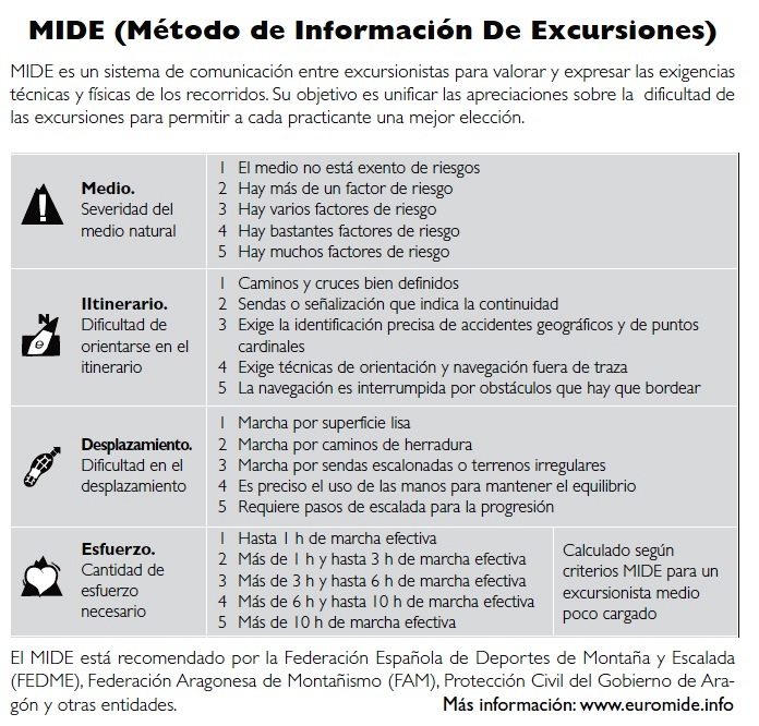
METHOD FOR THE EXCURSIONS INFORMATION
(MIDE)
- Severity of Environment: (1) The environment is not exempt of
risks.
- Orientation of the itinerary: (2) Pay attention at crossings.
- Difficulty of the trip: (1) Smooth surface.
- Amount of effort: (2) 1 to 3 hours of effective walking.
 |
It is fascinating to get into the Monte Corcos with tons
of paths and a variety of possible routes available. We enjoy a
forest that holds an important ecological richness. With outstanding
beauty due to its vegetation, it is one of the best oak forests in
Castile and Leon. |
